The city center of Kurashiki City is a well-known "tourist destination".
It is a town where many historical buildings remain, such as Kurayashiki, brick buildings, and cafes created by revitalizing old houses.
While tourists visit to enjoy the unique townscape of Kurashiki, for the locals living in Kurashiki, it is a "well-known town".
People who have lived in Kurashiki for many years may have fewer opportunities to walk around the town.
“I want the people living in Kurashiki to walk around the town. I want to create opportunities for locals to enjoy the town of Kurashiki that our predecessors have left behind.”
From this feeling, a "strong>Kurashiki Machiaruki Map" was born, which locals can enjoy.
Using a digital map, you can travel through three eras and experience each version of the town of Kurashiki.
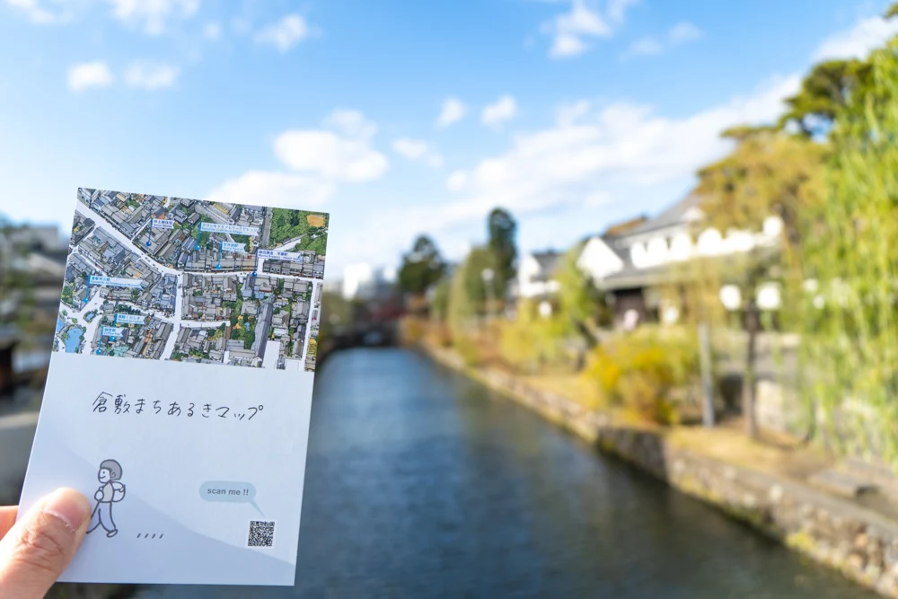
The author took a stroll around the town of Kurashiki with the Kurashiki Machiaruki Map in hand.
This article features the enjoyable ways to use the Kurashiki Machiaruki Map and interviews with three planners.
You will learn hints to enjoy the town of Kurashiki more deeply than before.
What is the Kurashiki Machiaruki Map
The Kurashiki Machiaruki Map is a digital map that uses location information and online maps linked to digital devices such as smartphones to convey the charm of the town of Kurashiki.
There are three types of maps from different eras, allowing you to enjoy how the town of Kurashiki has changed over time.
The types of maps are "Kurashiki City Bird's Eye View - 1963", "Kurashiki City Bird's Eye View - 2005", and "Old Town Name Map".
The two types of Kurashiki City Bird's Eye View maps use bird's eye illustrations drawn by local artist Okamoto Naoki.
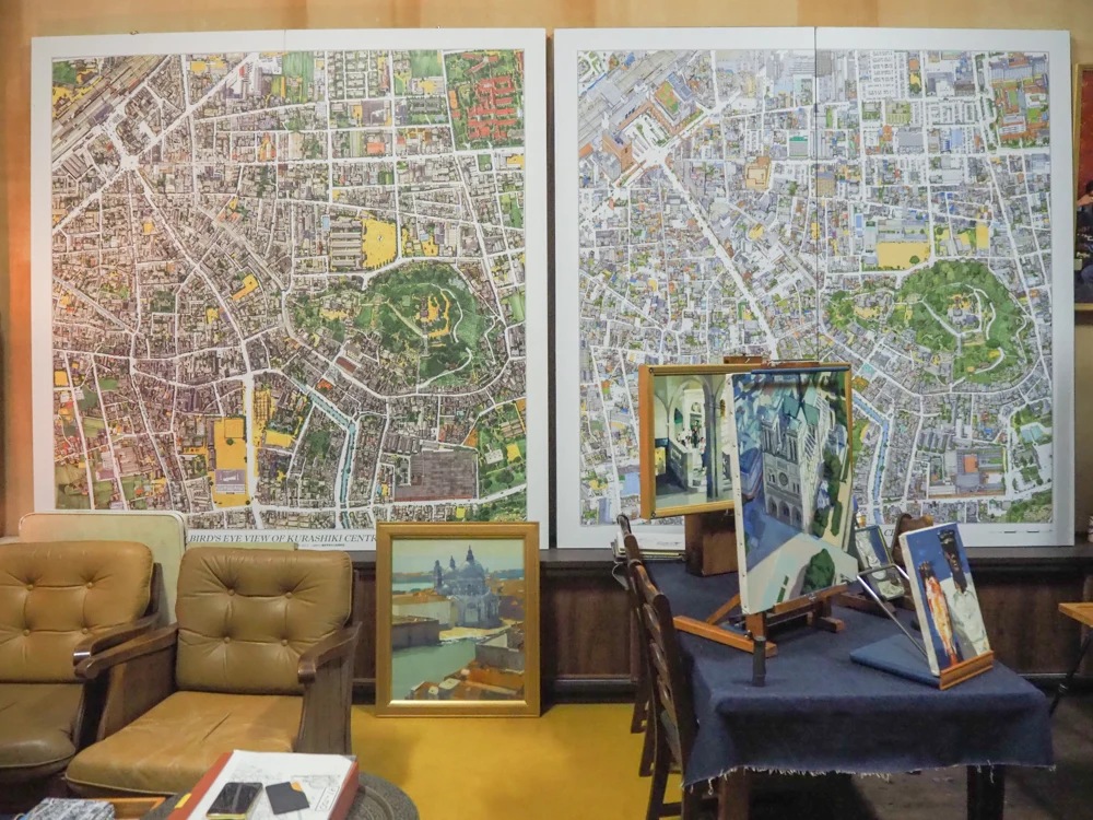
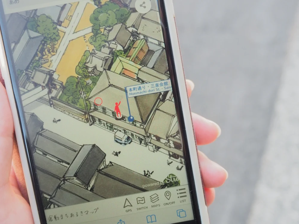
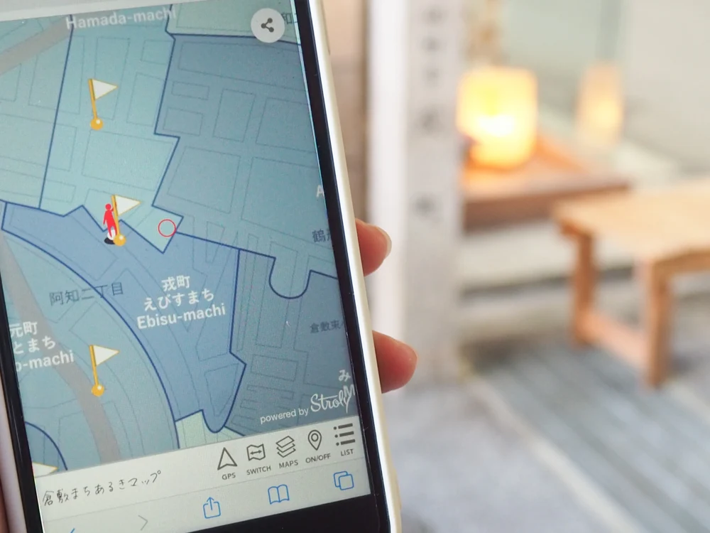
On the other hand, the Old Town Name Map allows you to learn about the administrative town names used by the former Kurashiki City in 1935.
The town of Kurashiki is a place where many buildings with distinctive architecture from different eras remain, including Kurayashiki from the Edo period, brick spinning factories from the Meiji period, and modernist buildings made of reinforced concrete.
Traveling between the three types of maps is enjoyable not only for understanding the history of the buildings but also for seeing the changes in the town.
This map is especially enjoyable for locals who know what the town used to look like.
How to Use the Kurashiki Machiaruki Map
Let me introduce how to use the Kurashiki Machiaruki Map.
When you open the URL of the Kurashiki Machiaruki Map on your smartphone, you will see a screen like the one below.
There is a menu bar at the bottom of the screen, so let's try operating it.
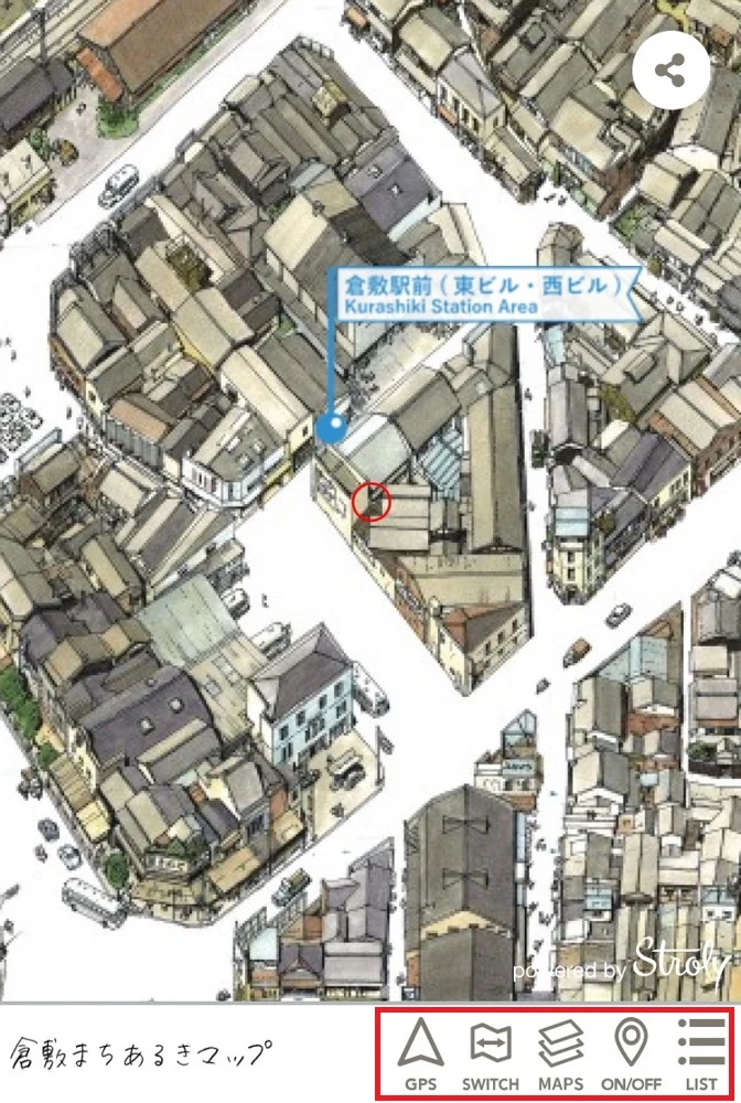
First, tap "GPS" and allow the use of location information.
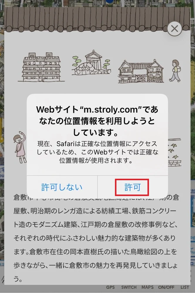
Then, an illustration of a person will appear almost at the same location as your current position.
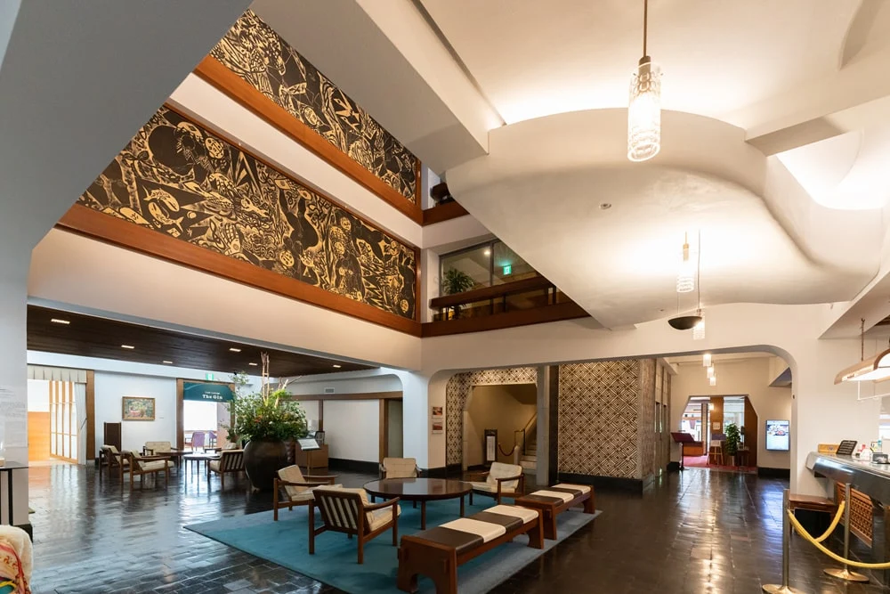
For example, if you link the GPS function at the Kurashiki International Hotel, the screen will look like the one below.
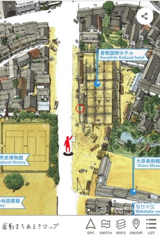
By the way, this is the map of "Kurashiki City Bird's Eye View - 1963".
You can see that the Kurashiki International Hotel was still under construction. It looks completely different from the current scenery.
Next, let's open a different era's map at the same location.
Tap the "MAPS" on the menu bar, and the map options will be displayed.
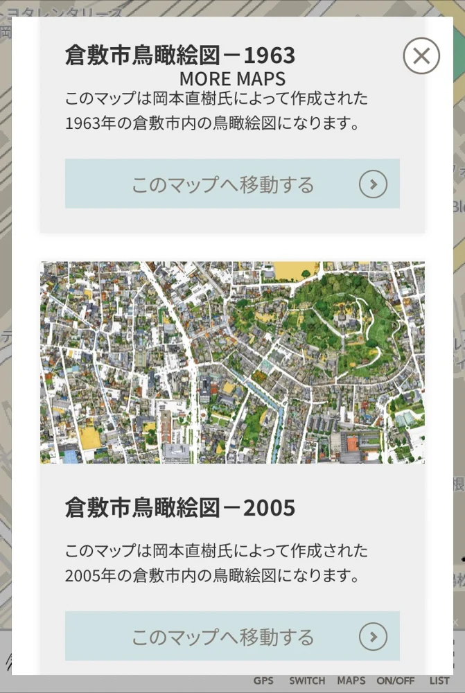
Let's move to the map of "Kurashiki City Bird's Eye View - 2005".
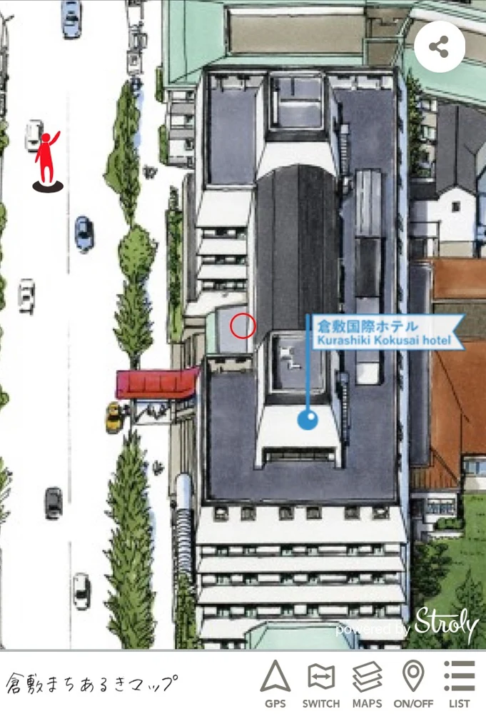
The Kurashiki International Hotel appears on the map, almost the same as the current scenery.
If you look closely at the two types of bird's eye view maps, you can see that cars are driving and people are walking.
By zooming in on the screen, you can see the bird's eye view maps in great detail, so please enjoy the map including the state of life at that time.
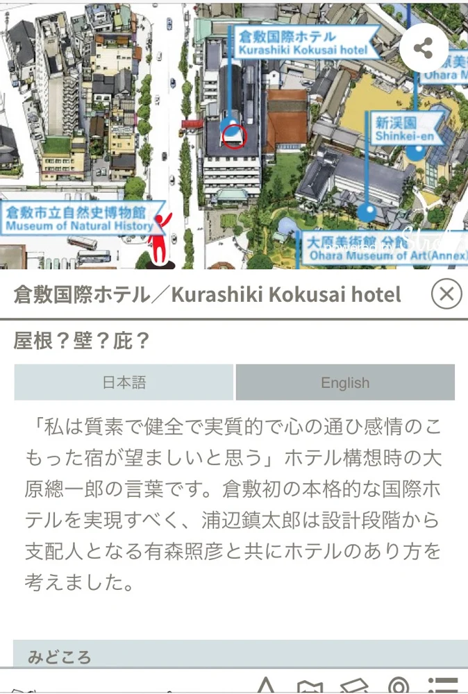
By tapping the flag of "Kurashiki International Hotel", you can learn about the introduction of the building and highlights.
And when you open the "Old Town Name Map", you will see not only the town names but also the locations where flags are standing.
The flags are located at the locations of the stone monuments where the old town names are written.
I also walked to check it out.
I visited the stone monument of "Ebisu-cho".
On the screen, by tapping the flag of Ebisu-cho, you can learn about the installation position of the stone monument and the origin of the town name.
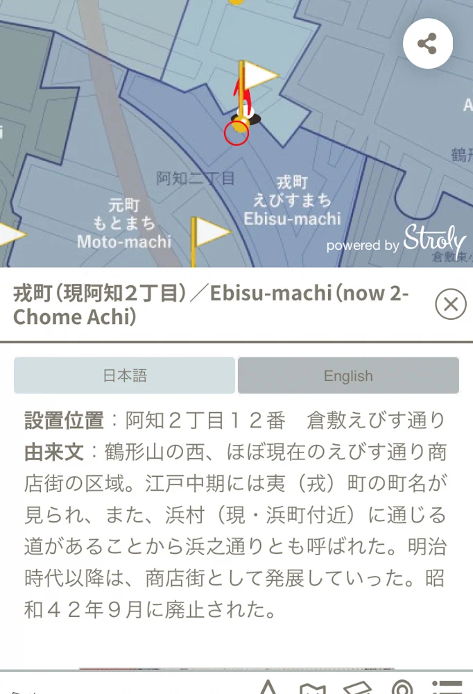
Looking at the Old Town Name Map made me feel like I had time-traveled.
By the way, if you tap the "SWITCH" in the menu, you can display the current map.
Some places may be firmly on the road now, but in the 1963 map, they might be standing inside a house!
Please enjoy switching between the maps of each era.
Walking while using your smartphone is dangerous. Please open the Kurashiki Machiaruki Map and enjoy it after you reach your destination.
Related Events Announced
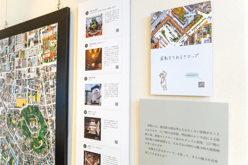
The Kurashiki Machiaruki Map is actually something that locals who have lived in Kurashiki for a long time can enjoy even more than tourists.
The reason is, "Because they know the old Kurashiki town".
While looking at the Kurashiki Machiaruki Map, conversations will surely bloom with "There used to be XX here..."
To allow everyone to enjoy both the different eras and the current Kurashiki, related events have been announced to commemorate the release of the Kurashiki Machiaruki Map!
How about taking a stroll around the town of Kurashiki from a different perspective?
The "Kurashiki Machiaruki Digital Stamp Rally 2021" has ended.
[Ended] Kurashiki Machiaruki Digital Stamp Rally 2021
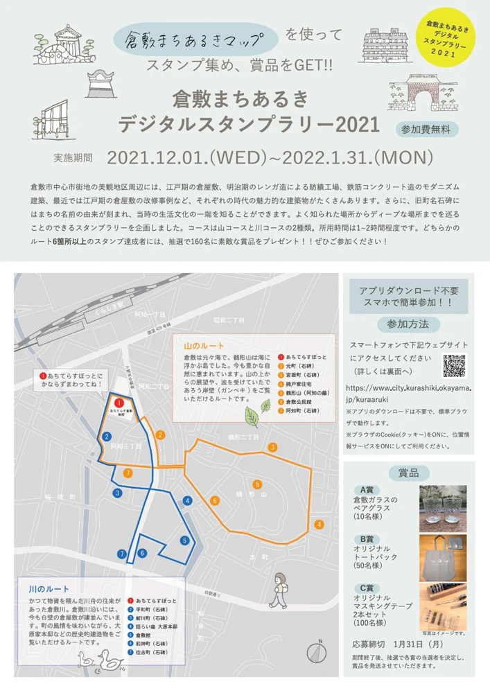
A stamp rally that tours from classic spots to deep places in Kurashiki will be held using the Kurashiki Machiaruki Map.
| Implementation Period | From December 1, 2021 (Reiwa 3) to January 31, 2022 (Monday) |
| How to Participate | Access the dedicated site with your smartphone |
| Dedicated Site URL | https://www.city.kurashiki.okayama.jp/kuraaruki |
| Prizes | Pair of Kurashiki Glass, original tote bag, original masking tape |
| Participation Fee | Free |
There are two routes: "Mountain Route" and "River Route".
Both routes take about 1 to 2 hours.
Among those who collect stamps at six or more locations on either route, 160 winners will be selected by lottery to receive prizes.
Please take a tour of the town of Kurashiki, which even locals rarely visit.
This event has ended.
![[Ended] Kurashiki Machiaruki Digital Stamp Rally (Held from December 1, 2021 to January 31, 2022) - Walking in Kurashiki While Feeling the Changes of the Times](https://media.kuratoco.com/wp-content/uploads/2022/01/23032501/DSC04465-Edit-2.jpg)
In addition to the events, there are places where postcards are set up.
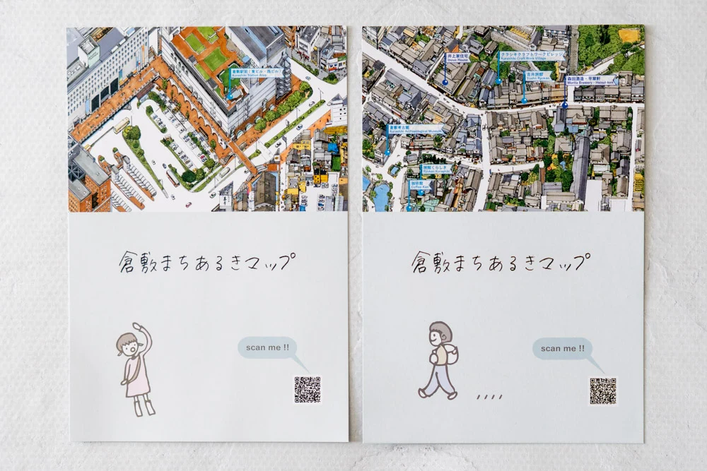
There are a total of six patterns of postcards.
By the way, the version placed at the Achiterasu Spot is the Kurashiki Station area version.
Please look for the others while walking around the town.
The Kurashiki Machiaruki Map and related events were planned by Hiromichi Shimizu from the Urban Development Division of the Kurashiki City Construction Bureau.
Also involved are Jiro Komoto and Nahoko Nakagawa from Urabe Design Co., Ltd.
I interviewed the three of them to hear about the inspiration for creating the Kurashiki Machiaruki Map and the ways to enjoy the map unique to the creators.